VN #068: The Mitchel River ~ Part I
Published: March 23, 2025
The Mitchel River ~ Part I
The Mitchell River wetlands lie in Cariboo Mountain Provincial Park – a corridor of glaciated peaks and densely forested valleys joining Bowron Lake and Wells Gray Provincial Parks.
The park is a critically interconnected habitat for endangered woodland caribou, which feed largely on the lichens of old-growth forests. It also shelters grizzly bear, black bear, mountain goats, moose, deer, and wolves.
The Lower Mitchell River and its tributaries are spawning, rearing, and foraging habitats for sockeye, coho, chinook, and kokanee salmon, as well as bull and rainbow trout. It is also a spring staging area for many species of waterfowl flying north.
The following images which were made over several years, introduced me to a vast and remote part of British Columbia. In the following two visual narratives we will follow the salmon upstream into the world’s only interior rainforest.
 The multi-coloured patterns of the Mitchell River delta and estuary where it enters the North Arm of Quesnel Lake.
 Later in the year when photographing a fishing expedition, we entered the river here, following the salmon into the rainforest.
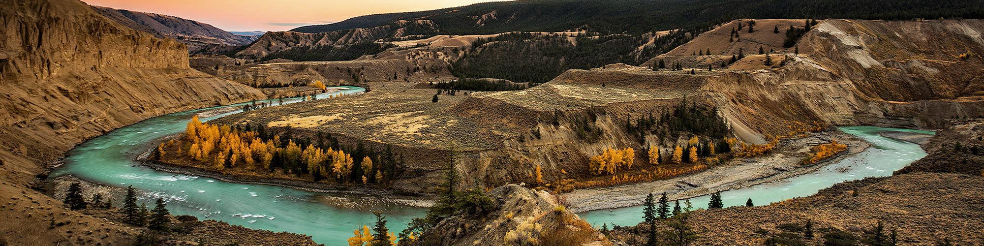
 The lighter coloured glacial water of the main channel contrasts with the deeper blue of the old oxbows, lagoons and wetlands.
 The Mitchell River delta in spring flood…..
 ….. is the time of year when new channels are born.
 As seen from the air, the old and new oxbow channels provide an historical overview.
Stay tuned for The Mitchell River, Part II; next week.
All of us at Chris Harris Photography thank you for your subscriber support!
Check out my Portfolio’s
Visit Exhibitions
Subscribe to my Newsletters
Subscribe to Visual Narratives